BRAC-BREAKER: PROPOSED ULTRA-MARATHON ROUTE ON CAYMAN BRAC IN THE CAYMAN ISLANDS

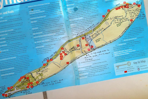
Course distance approx. 30 mi. Note: Untested course; no promises or warranty of any kind — you’re on your own. jwp 20140406
1. START/FINISH AND AIRPORT LOOP
- Brac Reef Beach Resort, run east; Turn Left at cross-over road (Alexander Hotel) to north side
- Turn Left at the T intersection (CNB bank), follow the paved road virtually to the west end, but a sandy path takes you to the beach which you will follow all the way past the air strip. Rejoin pavement and run through Start again
- Run along the south side road to the very end, and turn around there (Great Cave); run back to the mid-island cross-over road (Ashton Reid Drive)
- Turn right up the hill and cross the island, then down the hill on the north side.
- Turn right (east) onto the main road on north side. Follow it to the end including the path to the sea. Loop back several hundred yards to Peter’s Road. At Peter’s Road Turn Left (south).
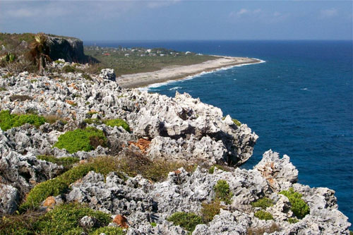
- Follow Peter’s Road up the high cliff and just after the high parking lot Turn Left onto a marked, grassy footpath.
- Follow Old Lighthouse Trail (grass and rocks) to the lighthouse. (It’s really a light beacon)
- Run west along the spine of the island, (Major Donald Drive) several miles to attain the Bight Road which is a traditional footpath.
- Turn Left (south) onto the Bight Road into the Parrot Reserve, and Left Again almost immediately onto the Nature Trail which is a grassy, rocky loop. When the loop comes to a T, please Turn Right again, and run north along the Bight Road.
- Run north along the grassy and rocky Bight Road (a traditional trail) across the paved road, along the boardwalk and beyond. ….
- Then down the wooden steps that carry you to the north side main road. Turn Left (west) along the pavement.
- Run west to the mid-island cross-over road (Ashton Reid Drive). Turn Left (south) up the hill and run to Songbird Drive. Turn right (west) on Songbird Drive.
- Proceed west on Songbird. When you reach a path called Hemmington Road (a rocky, traditional trail) Turn Right (north).
- Follow Hemmington Road to the wooden steps which carry you down to the main north road; then Turn Left (west).
- Run west to Stake Bay. At the Museum Turn Right (Kirkconnell St.) to the sea. Turn Left at the sea and follow Ryan Drive ‘til this road rejoins the main road. Turn Right and continue west. After the S- turn begin to look for Heights Rd. and Turn Left on it; run up the hill (gravel) and Turn Right onto the pavement. Run straight west on the high ground, past a right turn (don’t take it) and take the first Turn Left (south).
- Come to a T intersection and Turn Left. Follow the corner, climb the rise and Turn Right onto a gravel and rock road. Run west along this high ridge, past a hexagonal house and continue until forced to Turn Right
- Run downhill until you come to a T intersection. Turn Left at the T (now running west).
- Pass the first street but Turn Right at the second (now running north).
- Follow around the empty roundabout and down the hill to the main road. Turn Left . You are now on the main road, north side, running west.
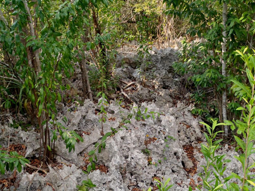
- At the Rubis Station Turn Left up the wooden steps, and follow Saltwater Pond Trail all the way south. It’s very rough but you will come to a boardwalk further on, then a smooth section, then a few steps down to pavement. Follow the paved street to the south side main road.
- At the T intersection Turn Right (west) onto the main road on the south side of the island.
- Run west without deviating, right back to the finish line, which was your starting line quite some time ago. Run a little further to clear the area.
2. SOUTH SIDE FLATS AND HALF-WAY BACK
3. UP AND OVER TO NORTH SIDE, THEN TURN EAST TO END
4. ALONG PETER’S ROAD, UP THE BLUFF AND RUN ALONG “OLD LIGHTHOUSE TRAIL”
5. LIGHTHOUSE TO “BIGHT ROAD” (Parrot Reserve)
6. BIGHT ROAD TO THE NORTH SIDE OF THE ISLAND
7. WEST ALONG THE MAIN ROAD TO THE MID-ISLAND CROSS-OVER ROAD
8. RUN WEST ALONG SONGBIRD TO HEMMINGTON ROAD
9.THROUGH STAKE BAY, TO AND THROUGH ALTA VISTA
10. SALTWATER POND TRAIL
11.RUN HOME

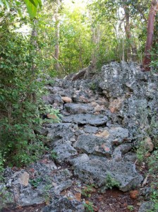
Pavers laid by our forebears on The Bight Road, north section. The term road in English conveys a right-of-way, but unfortunately most of our traditional paths have been changed to vehicular roads, at the very time that walkers/runners might prefer to use them in the old manner.
Two of the traditional trails remain intact. They served to lead inhabitants up onto their agricultural grounds on top of the bluff plateau, and across and down to the former coconut groves and rocky beaches. Often called “Windward” the south side shore also provided valuable items that floated in from other islands, like bamboo, glass bottles and any useful items that might have been tossed from ships.


