Investigation of the 17 Acre Parcel
“Parrot Reserve SouthWest” by Hugh O’Gara and J. W. Platts
Introduction

This report to the National Trust for the Cayman Islands was authorized by its Cayman Brac District Committee. Under Trust Law and Regulations, Regulation 7 (2) states “The work of the District Committees shall include … surveying and inventorying significant … natural resources”. The report puts on record a description of a unique piece of land, added to the Parrot Reserve by its previous owner Donald K. Pennie. At present, this is the only portion of the Parrot Reserve that lies on the west side of The Bight Road, the traditional trail that people have followed from the north side of Cayman Brac (where most lived) to the south or windward side.
Part of this land had enough “red mold” to convince the old-timers to plant traditional vegetables and fruit there. This practice probably ceased about 40 years ago.
Lands and Surveys department maintains a record of this piece: Block 104A Parcel 23. A map can be purchased for a modest fee.
Methodology
The volunteers walked thin, straight lines on compass bearings, through selected terrain representing a small sampling of the total area. Detailed methodology is presented as Appendix 1 at the end of this report.
Land types
Land types along the property, as seen from The Bight Road heading south and looking west, are as follows:
- High ridge running EW along the northern boundary of the 17 acres, where it borders the property now being developed for a housing estate of some kind.
- Sparsely treed area. Smaller trees as if thinned or badly hit by the hurricane
- Big sinkhole (25’ feet deep) with large fig tree: Cherry, Bullhoof, Pompero, and others.
- Thicker bush again.
- Grass Piece (old provision ground). Wild cocoplum at the border.
- Old mango trees (sparse bush again, as if once farmed); “Licorice”, Agave .
- South bluff edge close by and an E-W ridge again: sparse, wind-beaten bush.
- South bluff edge, still vegetated but the trees are stunted from exposure.
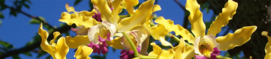
Photos
The photos include highlights of the hikes including the Polkadot Wasp Moth (species not yet confirmed) and the rare Yellow Sanders tree (also called Satinwood tree).
Key findings
1) VEGETATION TYPES The table taught us something. Although the deep forest is the most attractive (one place we found “biodiversity heaven”) the other two types are also very valuable and deserve permanent protection. The cliff edge on south side is very diverse (see Table) although the trees are stunted. It is more diverse than the lighthouse (east end bluff edge). That bluff has a path and was once purposely burned. The third land type is the abandoned provision ground and we did not expect such diversity as we found. Obviously the best policy is to let such lands revert to nature. This may be best for abandoned rock quarries too — perhaps adding a layer of “quarry dust” and mulch.

2) SINKHOLES ONCE CONNECTED TO UNDERGROUND STREAMS OPENING INTO CAVE MOUTHS are clearly demonstrated here, at least in the extreme south end. The many sinkholes lead to known caves in the cliff face, the vertical terrain owned by the Queen and not always well protected on this island. This system no longer shoots torrential rain out the face of the cliff but remains very important as “edge” cover for birds, nesting habitat for boobies and tropicbirds, and in general, terrain that is safe from most of our imported predators.
3) SURPRISES are hidden everywhere in the untamed portions of Cayman Brac. Most people have never seen a Yellow Sanders tree (Satinwood), and to find one that is stunted like the cliff-edge Red birches is quite amazing.
There’s another large tree described in our field notes which is a total mystery — we’ll go back and check it.
The Polkadot Wasp Moth look-alike will puzzle us until someone sorts it out. (Family Arctiidae. See photo on the website.)
A bed of Peperomia needs investigation since we were not sure of it.
4) The Lincoln Penny markers are small treasures waiting to be found. The American D. K. Penny carefully surveyed his land, which he treasured. (He had a crude bench near the south end of The Bight Road.) Mr. D.K. Pennie made these markers out of blobs of cement thrown onto limestone, and set a Lincoln penny in each.
5) A good Candlewood tree was photographed, measuring about four inches in the bole.
6) We saw a relic tree from the ’32 storm, but it stands west of the western boundary of our Trust land. This is gigantic Mastic that was “topped” back then, and subsequently re-grew a great crown. It does not seem to have been hurt by Hurricane Paloma on 2008. Here and there on the Brac, these giant relic trees can be found. They serve to show how large the trees grew in the primary forest before chopping began. (This writer knows of only one location of untouched forest on the Brac.)
7) The LURE OF THE UNKNOWN still exists on Cayman Brac. These 17 acres remain ready to be discovered by the next explorer, because we only sampled a tiny part. What great sinkholes, caves and we hope iguanas remain hidden?
Landforms and creatures

The heavily eroded, difficult terrain called Karst limestone formation is the most amazing to hike through, with many severe ups and downs while trying to keep a straight route. But all three vegetation types play a role in nature and there were some good sightings. These are taken from the field notes: Zenaida dove, Caribbean elaenia, Cayman parrots, Catbirds, Mockingbird, Vitelline warbler (only five feet from us!), Bananaquit, Thick-billed vireo, Little Cayman anole, caterpillar of the sphinx moth; large spider with yellow-banded middle wrapping a big white butterfly. Some of the caves we came upon have stalactites inside, but we never took the time to crawl into them.
Recommendations to the National Trust
This is great land and should be left strictly “as is”. The fact that the Trust owns land on both sides of The Bight Road may help prevent the downgrading of this footpath into a vehicular road, a fate that has befallen several trails that Trust volunteers helped keep in the public domain. Cayman Brac is the “most modified” of the three islands; and Cayman Brac has the smallest percentage of protected land of all three islands (only 3.2%) This percentage is only one-third the percentage on Grand Cayman. We must ADD protected land, since NT ownership is, in the absence of a national park system, the only sure way to keep some land in the state it was in when Columbus sailed by. It is a living history lesson at a time when children and adults see only virtual reality and indoor pursuits. Kids can actually enjoy a “Wilderness Adventure” without lining up in a theme park – and ours is real, not re-created by landscape artists.

A high priority should be to purchase the land below the Parrot Reserve on the south, along its whole length, and to the sea. This will prevent a hotel or other large building from being built on the big, single land-holding below, which would threaten the edge, the Yellow Sanders to the west of The Bight Road and the Banara caymanensis the same distance west. The Banara is a Sister Islands exclusive tree, one of only two “full species” Sister Island endemics. For history buffs, this could allow the National Trust to restore The Bight Road trail, railing and steps to the foreshore leading to the sea. The complete trail existed until very recent times when it was blocked by a private owner.
A question for a geologist: The two densest woodlands are both on fairly narrow ridges, and show signs of ancient rivers (above-ground, not undersea since they include sinkholes that carried water to cave exits in the cliff face). Why do we find ancient streambeds on the highest areas of the whole 17 acres? We’re not used to rivers on top of high ridges!
Another valuable “chore” that should be done is to walk the western boundary of this 17 acres, end to end.
THE END
Hugh O’Gara
J.W. Platts (writer)
Table
This inventory of trees and plants is presented as a table, organized by THREE of the above land types: 1. Karst limestone forest; 2. South bluff edge; 3 Abandoned farmland.
Type #1 was represented by three different places: a) north ridge; b) western extremity beyond the plantation ground; c) south ridge. The south bluff edge was walked more than once and the plantation ground only once, plus the return trip.
Click here to see the table
Additional photos can be viewed here.
Appendix – 1 [Methodology]
Appendix – 2 [Historical note about The Provision Ground]